After crossing into Chile from the northern region, we rode through the eastern edges of the arid Atacama desert. At the outskirts of Arica we admired some petroglyphs on the slopes and some creations that resembled a stage out of a science fiction movie. The first 350 kilometers on the ruta 5, the Chilean Panamericana Norte, were tough because of the heat and the scorching sun. There, the Atacama desert is much more hostile in relation to the coastal desert of Peru. The thermometer had climbed over 35 degrees Celsius, but noticeable temperature was much higher. The open horizon in every direction was discolored by the reflection of the sun and that enhanced the feeling of the dead desert.
[imgslider-wrapper]
[imgslider imgurl=”1847″][imgslider imgurl=”1848″]
[/imgslider-wrapper]
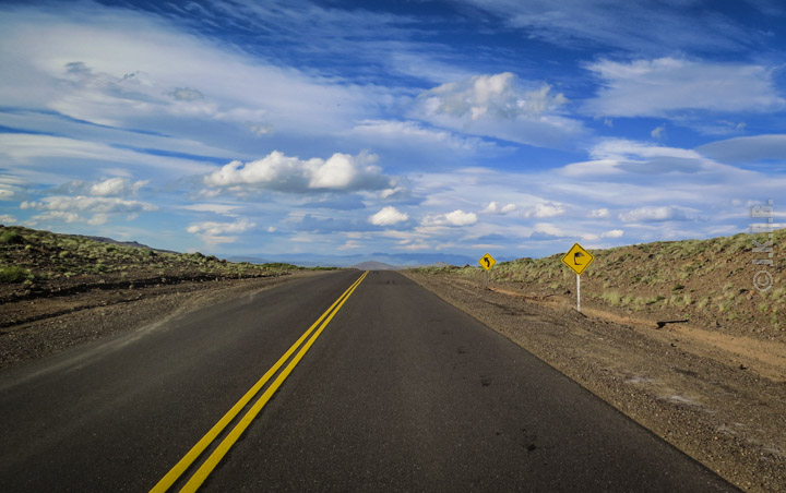
A couple of days later we turned once again towards the high mountain passes and the high plateaus of the Andes. The route to Paso Jama, from where we entered Argentina, is fascinating. We had returned to planet Mars! On our left we could see the mountains of that unbelievable country that Bolivia is, and the segments of the route of the lakes we had crossed in September. We got goosebumps. Enthusiasm and so strong emotions. We stopped for a few minutes at one side of ruta 27 at 4,500 meters altitude, gazed at the place that had charmed us, that made us lose our minds and tested our limits a couple of months earlier. It acquires another dimension, looking at the longer distance and knowing now that we had tamed that eerie vast and inhospitable land. The ruta 27 (Chi) / ruta 52 (Arg) runs through the Paso Jama. It’s all paved and easy. Other than the surface of the road, there is not much different from the Paso Sico and the ruta 51, 80 kilometers to the south that we had climbed 2 months ago (see part 1 of this expedition). It’s the same Martian landscape. The salars. The flamingos. The thin atmosphere. It’s all there and we were wondering again. Are there really such landscapes on this planet ?
[imgslider-wrapper]
[imgslider imgurl=”1849″][imgslider imgurl=”1850″][imgslider imgurl=”1851″][imgslider imgurl=”1852″][imgslider imgurl=”1853″]
[/imgslider-wrapper]
After the border post of Jama, starts the gradual transformation of the landscape. As we moved to the eastern side of the Andes sand disappears, the mountains change color and form. The almost perfect geometric shapes of the conical volcanic peaks protruding to great highlands are replaced by colorful and diverse solid massifs that extend across several tens of kilometers. It is the now the land of the many quebradas («broken mountains»), large canyons and large valleys of the Provinces of Jujuy and Salta.
The quebrada of Purmamarca at that time of year was boiling. Yet, from one day to another we encountered rapid changes of weather conditions. From extreme heat to torrential downpours that turned the ruta 9 to Salta into a brown stream of water filled with mud. We followed ruta 68 once more through the unique Quebrada de las Conchas, which we had seen at the beginning of the trip. We passed from Cafayate, a picturesque small and very quiet town surrounded by vineyards, where the famous Argentine wine variety of Torrontes is made.
Τhe infamous Ruta 40 which runs Argentina from north to south welcomed us with intense heat. High temperatures were the dominant feature of the days that followed. For the next 600 kilometers through the provinces of La Rioja and San Juan, to the center of the province of Cuyo, the landscape can not excite. Huge flat, arid, desert land until the outskirts of Mendoza.
Image slider: The Lipan Slope – Quebrada de las Conchas – Flooded road to Salta – Sandy stretches of Ruta 40[imgslider-wrapper]
[imgslider imgurl=”1855″][imgslider imgurl=”1856″][imgslider imgurl=”1857″][imgslider imgurl=”1858″]
[/imgslider-wrapper]
Just a small part of 20 or so kilometers, between Chilecito and Villa Union, offers a short break from the dull pictures that surrounded us. There, the road passes through a red colored canyon with beautiful vistas to the mountain range of Sanogasta and the valley below. Before reaching Mendoza we were hit by one of the most menacing sandstorms we had ever experienced. Everything and anything disappeared from our sights and the force of the wind was such that made riding intolerable. We reached Mendoza completely exhausted many hours later, having been unable to find shelter to protect ourselves during the sandstorm.
We spent a few days in this beautiful city, resting, gathering our strength and enjoying delightful Argentine wine varieties. It was time to cross into Chile once more. We crossed the plains of Lujan de Cuyo with the countless vineyards in the south of Mendoza to get on the ruta 7 to the border. Soon began peeping on the horizon the huge granite Andean mass that gradually filled our field of view from edge to edge. In the center enthroned an imposing mountain, the peak Aconcagua, the second highest in the world at 6,960 meters. That image combined with the fact that it was the last time in our trip that we would see the Andes on such a scale, in all their magnificence, brought a lump in our throat and a feeling of awe, just as had happened almost three months before that, when we first came upon the longest mountain range of the world. The route that day, from Mendoza to Santiago, goes through the Paso Libertadores at an altitude of 3,200 meters. Although not the highest mountain pass in the Andes, it is equally cold and breezy.
[imgslider-wrapper]
[imgslider imgurl=”1859″][imgslider imgurl=”1860″]
[/imgslider-wrapper]
At Santiago we had some maintenance work done on the motorcycle and we put new tires. At December 15th, we left the Chilean capital continuing our course to the south. But first we went to the serene Isla Negra, a charming little town by the shores of the Pacific, where we payed a visit to the house of the Nobel prize winner, writer novelist Pablo Neruda. A few uneventful days and a few hundred kilometers later, we changed again direction and we entered Argentina. We were officially entering Patagonia! This land was holding for us a treat, one for which this place is notorious. The patagonian winds. The warning yellow road signs with a tree that bends in the wind is like a trademark of Patagonia.
The wind! That wind! It is terrifying and frustrating altogether to realize that you are completely helpless and unable to control the bike when it is hit by that wind, that nature has complete control and tosses you from one end of the street to the other, in seconds, just like that. We called our first day in Patagonia at Zapalla. The next chapter of our journey was about to start.
(Images courtesy of John Kapelakis & Elena Bitsika)