19-day Self Guided Motorcycle Tour of Greece
19-day self-guided motorcycle tour of the Peloponnese region, and Central and Northwest Greece and the Pelion peninsula. 3,900 km covering UNESCO sites, mountain passes, and coastal routes. Includes 18 nights accommodation, motorcycle rental with luggage equipment, GPS navigation with pre-loaded routes, and insurance with excess. Five optional rest days. Flexible departure dates. Advanced difficulty. Prices from €3605 per rider
This page presents the tour broken down in the following sections:
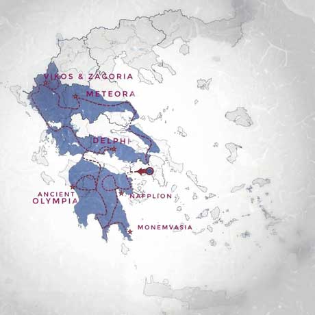
This 19-day self-guided tour combines the core Peloponnese route with the northwestern mountain ranges and the Pelion peninsula – three distinct riding environments that together represent the full spectrum of Greek motorcycle touring.
The way this tour differs from our 16-day tour: the Pelion peninsula is added in the last segment of the itinerary and there are now five optional rest days instead of three.
The progression of the tour is deliberate. You’ll start in the Peloponnese (Days 1-6), riding the eastern, central and southern regions: Nafplion, Monemvasia, the Taygetos crossing, the Mani Peninsula and the Arcadian mountains. This section establishes your familiarity with Greek mountain roads before the northwestern territories.
From Day 8 onward, the route moves into Central and Northwest Greece – specifically the Pindus mountain range. This is the section we’ve refined over a decade of guiding groups through Zagoria and Tzoumerka. The terrain becomes progressively more remote and technically demanding. By Day 15 (Tzoumerka), you’ll encounter the most challenging riding we offer anywhere in our route network.
Pelion is introduced in the route in the last section (Days 17-18) before your return to Athens on Day 19.
The tour covers both UNESCO World Heritage Sites (Mycenae, Epidaurus, Olympia, Mystras, Delphi, Meteora) and remote mountain territory that remains largely unknown to international riders. Daily distances range from 165-330 kilometers, with most days averaging 4-5 hours of riding. Five optional rest days are built into the itinerary.
This version suits experienced riders who want comprehensive coverage of Greece’s best riding within a single trip. The technical demands are significant – this is classified as Advanced difficulty throughout, with sections that push into expert territory
Customers who did this tour wrote on TripAdvisor:
… the route for our 19 day self-guided tour took us on lots of adventurous sealed roads, away from highways, which the bike was very suited for. We went to places away from the touristy areas, which we thoroughly enjoyed, stopping at little villages for breaks, which didn’t get many tourists. So we went and experienced lots of places most people who go on Greek holiday do not go to. The trip information guide with printed maps of the routes was very informative and included suggestions of places to visit. The GPS was easy to use with the daily routes and loop trips, when staying in a place for 2 or 3 nights, easy to follow. Accommodation was high quality with breakfast included. There was always a safe place to park the bike. An excellent adventure. Motogreece is a very professional business and would not go anywhere else for a Greek motorbike holiday.
… we had one of the best trips we have ever taken! My wife and I took the 19 day self tour and it was arranged perfectly. We were on a 750GS and it was a great size for the small roads and villages. The hotels we stayed at were a perfect match for us. The research that went into coming up with the routes and accommodations was obviously a monumental task and John and John did a great job!
This Tour at a Glance:
Start & Finish : Athens, Greece
Duration: 19 days riding days with options to extend
Riding hours: Daily average: 4-5 hours on the saddle. A couple of days are longer (ca. 6 hours).
Distance: 3,100 – 3,900 kilometers (riding options on rest days) / 1,900 – 2,400 miles
Accommodation: Mostly 4 star, elegant boutique hotels. All of them top rated and personally selected by us
Roads: 100% paved. A large amount of this tour runs on narrow, single lane, secondary mountain routes.
Difficulty: Advanced. See section below for better understanding
TYPE OF RIDING
What to Expect Across 19 Days.
This tour divides into two distinct riding environments with different technical characteristics and infrastructure realities.
Days 1-6: Peloponnese
You’ll ride predominantly on secondary and tertiary mountain roads with minimal traffic outside town approaches. The core technical sections – Taygetos Pass, Mount Parnonas, and the northern Arcadian mountains – involve sustained curves across 50-80 kilometer stretches.
Surface quality is generally excellent on main mountain routes, with occasional rough patches in villages and remote areas. The longest day of the Peloponnese section (Day 5: Mani to Dimitsana, 240km) combines coastal departure, a major mountain crossing, and arrival in a mountain village – expect 6-7 hours total including stops.
The Taygetos crossing specifically requires attention: 30km of continuous climbing with tight hairpins, steep grades (8-12% in sections), and road width that narrows to single-lane in places. You’ll manage dozens of hairpin turns, many blind, while climbing to approximately 1,200 meters elevation.
Days 7-8: first Transition section, to Central Greece
Your exit from the Peloponnese includes riding the mountain passes of Helmos before crossing the corinthian gulf to Nafpaktos. This is an intermediate point of the tour. You may choose to rest or ride an optional route that takes you east to Delphi (UNESCO World Heritage Site), on fast flowing provincial roads.
Days 9-11: second Transition section, to Lefkada
Lefkada Island serves as recovery time between the Peloponnese mountains and the northwestern ranges. Riding is straightforward – coastal roads with standard infrastructure, minimal elevation changes, clear sight lines. Use these days to rest.
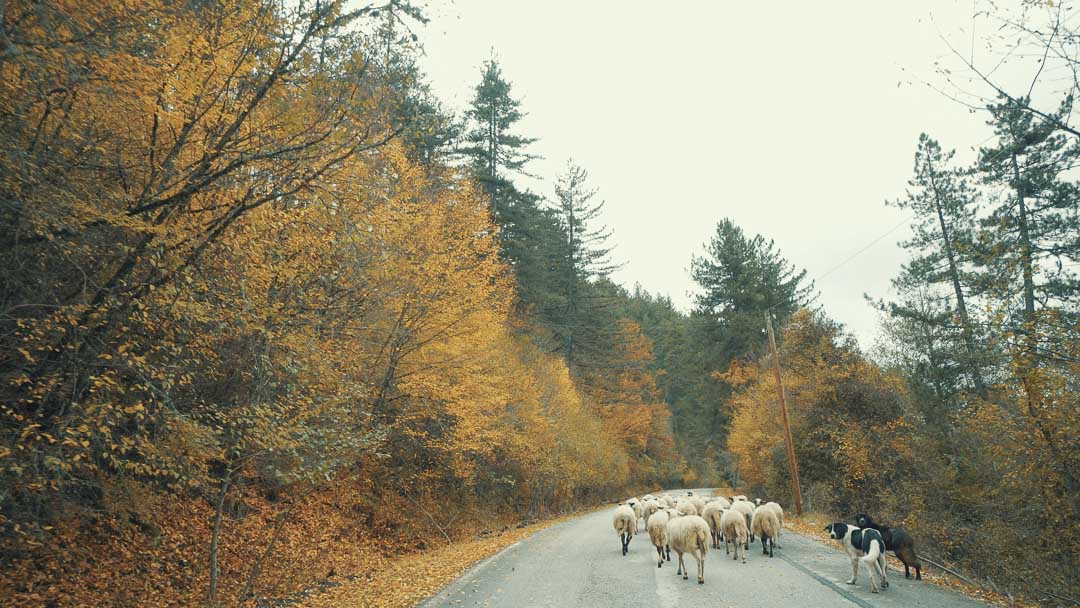
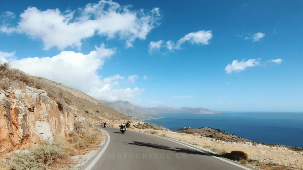
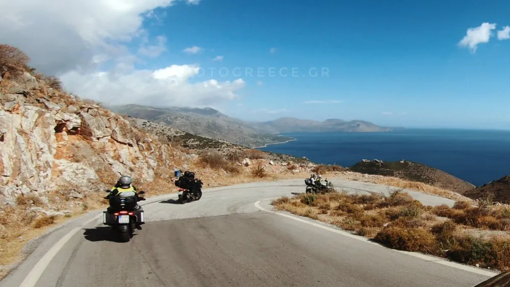
Set of images of roads from the Peloponnese section of the tour:


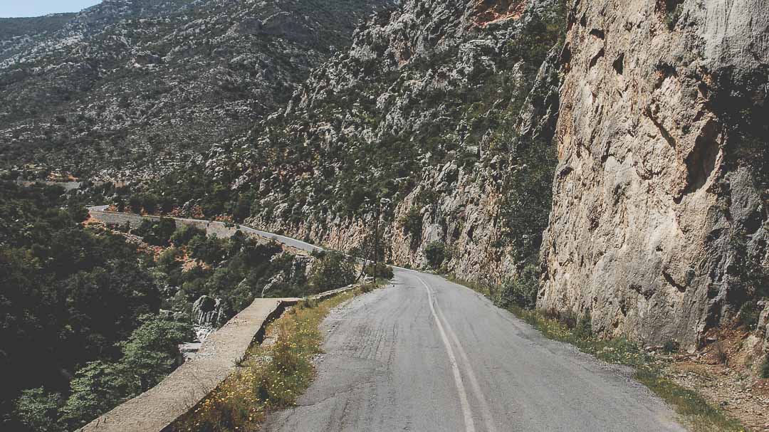

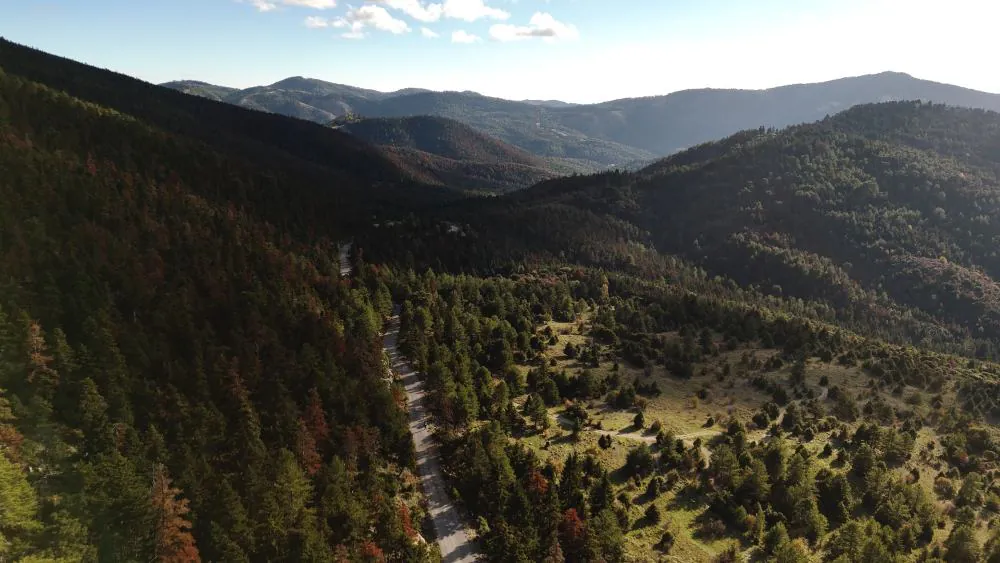
Days 12-16: Central & Northwest Greece
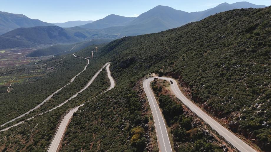
The technical demands increase significantly once you enter the northwest territories on Day 12. From that day onward, you’ll ride predominantly on narrow secondary mountain roads where standard lane widths don’t apply. Single-lane sections are common, particularly on ridge routes and in gorges.
The Zagoria loop (Day 13) delivers continuous switchbacks across 100+ kilometers with minimal straight sections – sustained technical riding, not occasional corners punctuating longer straights. Expect 5-6 hours in the saddle despite only 185km distance.
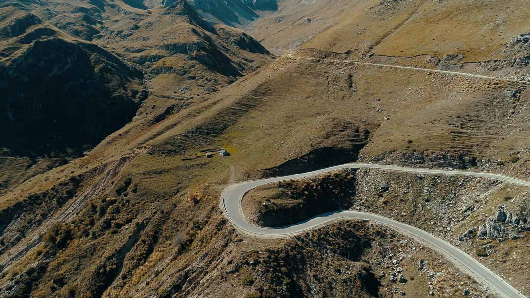
Tzoumerka (Days 15-16) represents the most challenging section of any route we offer. The approach from Zagoria via Metsovo and the exit toward Meteora both involve steep, sustained gradients with tight hairpins where you’re managing clutch, throttle, and lean angle simultaneously on 12-15% grades.
Road surfaces in Tzoumerka reflect the maintenance realities of remote alpine infrastructure: expect loose stones from cliff faces, short repaired sections, and occasional potholes – particularly after winter. These aren’t token “adventure” elements; they’re operational conditions you’ll manage across extended sections.
The Baros Pass (1,900m – highest paved pass in Greece) requires specific attention. In early May, snow melt restricts usable road width to approximately one motorcycle width at the summit. Later in season, the pass is clear but remains exposed to weather that can change visibility and grip rapidly.
Traffic is minimal throughout the northwest sections. You’re more likely to encounter livestock, agricultural vehicles, or logging trucks than tourist traffic. Services (fuel, food) can be 60-80 kilometers apart in Tzoumerka and eastern Zagoria.
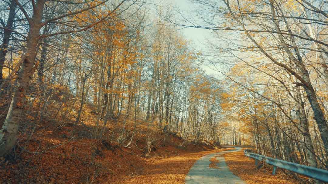
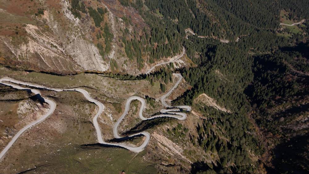
Set of images of roads from sections of the tour in the Northwest :


Road Surface Reality:
Most routes are paved, but “paved” in remote Greek mountains means surfaces maintained for local use, not tourism infrastructure. Short sections (50-100 meters) of gravel or dirt appear where repairs are ongoing. This is normal mountain road management in regions with extreme winter conditions.
Required Skill Level:
Advanced riders only. You need demonstrated ability to handle sustained steep switchbacks, manage a loaded bike on rough surfaces, and maintain concentration across 4-6 hour riding days on technical terrain. Tzoumerka specifically demands expert-level clutch control and throttle management on extended steep grades


HIGHLIGHTS OF THIS TOUR
UNESCO World Heritage Sites (6 total).
Peloponnese:
- Mycenae: Bronze Age citadel with Lion Gate and cyclopean walls
- Epidaurus: Ancient theater known for acoustic properties
- Olympia: Birthplace of the Olympic Games
- Mystras: Byzantine fortress-city on Taygetos slopes
Central Greece:
- Delphi: Ancient sanctuary on Mount Parnassus slopes overlooking the Gulf of Corinth
- Meteora: Six active monasteries built atop 400-meter vertical rock formations
Core Geographic Regions
Peloponnese (Days 1-7):
- Nafplion: Venetian-era harbor town with Palamidi fortress
- Monemvasia: Medieval fortress town on coastal rock island
- Mani Peninsula: Arid terrain with traditional stone tower houses and Cape Tainaron (southernmost point of mainland Greece)
- Diros Caves: Underground lake system accessible by boat
- Taygetos mountain range: Major alpine crossing reaching 1,200m
- Arcadian mountains: Forested highland terrain with traditional villages
- Mount Parnonas: Long forested range defining eastern Peloponnese
Central Greece (Days 7-8):
- Nafpaktos: Venetian-era harbor town on Gulf of Corinth with hillside fortress
Western Coast (Days 9-11):
- Lefkada Island: Connected to mainland by causeway (no ferry), providing recovery time between mountain sections with developed beach infrastructure
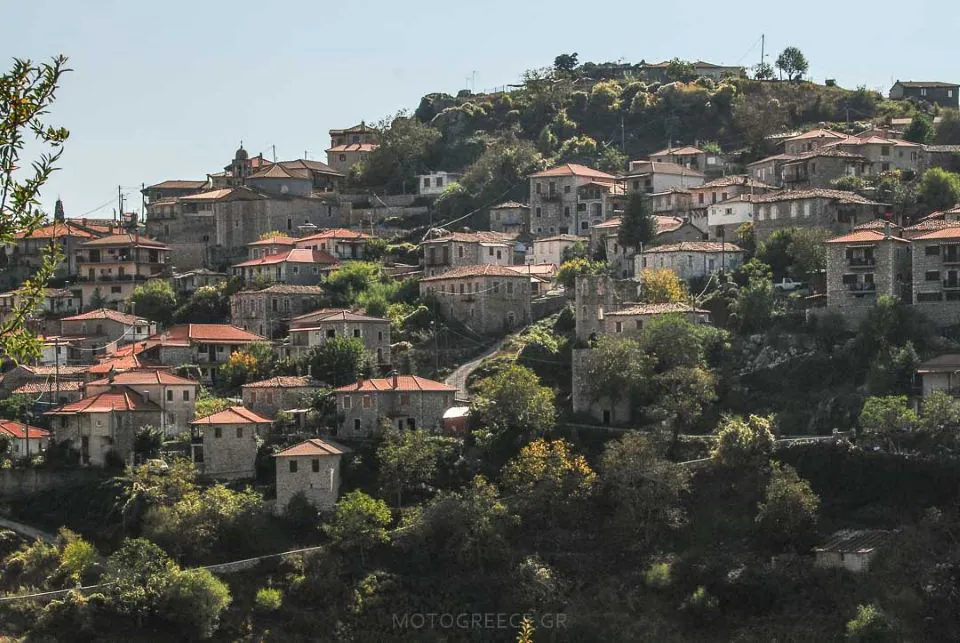
Northwest Mountains – Zagoria (Days 12-14):
- Zagori region: 46 traditional stone villages (Zagorohoria) spread across mountain terrain between 600-1,200m elevation, connected by single-lane mountain roads
- Vikos Gorge: Canyon measuring 12km long with depths reaching 900m – one of Europe’s deepest relative to width
- Voidomatis River: Limestone-filtered tributary flowing through the gorge system, crossed via traditional stone bridges
Northwest Mountains – Tzoumerka (Days 15-16):
- Tzoumerka range: Remote section of Pindus mountains with limited infrastructure – the most technically demanding riding in our route network
- Baros Pass (1,900m): Highest paved pass in Greece with exposed approaches and significant elevation gain
- Kalarytiko Gorge: Deep river gorge with villages built on cliff faces and narrow roads with minimal shoulder width
Pelion Peninsula (Days 17-18):
- Pelion mountain range: Peninsula extending into the Aegean Sea with mountain elevations reaching 1,600+ meters. The terrain is densely forested (beech, chestnut, plane trees) with limited visibility beyond immediate road corridors.
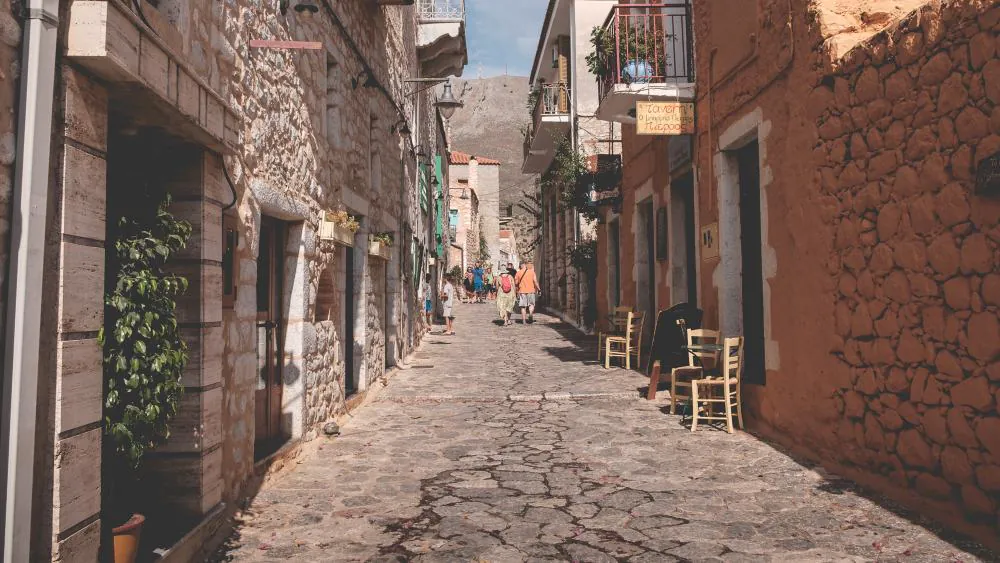
- Mountain villages: 26 traditional settlements, most of them built between 600-800 meters elevation, others along the coast. Villages like Makrinitsa, Vizitsa, and Tsagarada feature 18th-19th century stone architecture with slate-covered mansions.
Return Route (Day 19):
- Island of Evia. A ferry crossing is required (25 minutes, departures hourly in season)
Route Structure
The progression moves from recognized landmarks with established tourism infrastructure into increasingly remote mountain territory, then back through more accessible areas for the return to Athens. This structure allows riders to build familiarity before the most demanding sections (Tzoumerka) while ensuring comprehensive coverage of both cultural sites and technical riding challenges.
ITINERARY
Day 1: Athens – Nafplion (185 kilometers / 115 miles) – 2 nights in Nafplion
The first day eases you into Greek riding conditions without overwhelming. You’ll start on a secondary coastal route that bypasses Athens’s highway system, then cross the Corinth Canal before heading inland toward Epidaurus.
The section from Corinth to Epidaurus follows one of the most popular routes among Greek riders — well-maintained pavement, moderate curves, and enough technical interest to settle you into the bike without demanding full concentration. The road offers good sightlines and consistent surface quality.
Plan 1-2 hours for stops if you visit both the Corinth Canal (5-10 minute photo stop) and the ancient theater at Epidaurus (30-45 minutes including the acoustics demonstration, which happens naturally when tour groups arrive). The theater is directly on your route, not a detour.
From Epidaurus to Nafplion, the route stays relatively flat. You’ll arrive in Nafplion by late afternoon, giving you time to explore the old town on foot before dinner. The town center is car-free, which is why we chose accommodation here — you’ll walk, not ride, to restaurants and the Palamidi fortress.
Timing note: This is deliberately your lightest day. Most riders arrive from international flights the day before and are still adjusting to time zones and bike familiarity.


Day 2: :Loop Ride from Nafplion – Mainalo Mountain (225 kilometers / 140 miles)
You’ll depart Nafplion heading north to stop at ancient Mycenae (UNESCO site, requires 20km detour from main route, 45-60 minutes if visiting). The ruins include the Lion Gate and cyclopean walls from Bronze Age Greece. The site requires uphill walking on uneven terrain.
From Mycenae the route continues west into the Arcadian mountains, specifically the Mainalo range. You’ll climb gradually through forested terrain, reaching elevations around 1,200 meters. The riding features continuous mountain curves and switchbacks, with minimal straight sections — technical but not extreme, with good pavement and moderate traffic near larger villages.
The loop’s highlight is the return descent via the Achladokampos route — a technical section with tight switchbacks and coastal views toward the Gulf of Argolis. This is a local favorite among Greek riders, known for rhythm and flow rather than extreme technicality.
Expect 4-5 hours of riding time. The loop brings you back to Nafplion by late afternoon, giving you time to rest before dinner. No packing required tonight — you’re staying in the same room.
Riding character: Continuous curves, forested terrain, well-maintained roads, moderate technical demand.


Day 3: Nafplion – Mani area, 2 nights in Mani (185 kilometers / 115 miles)
Today you’ll cross Mount Parnonas — a long, forested mountain range that defines the character of Greek mountain riding. The route starts coastal heading south, then turns inland for an 80km climb through dense pine forest.
Once you’re above the treeline, expect continuous curves with minimal straight sections, constant elevation changes, many switchbacks, and road width that narrows to single-lane in places with passing zones. The pavement quality is good, but the isolation is real — you may ride 2-3 hours without seeing another vehicle. This is normal for Greek mountain roads outside tourist season, but it means self-sufficiency matters. Check your fuel before the climb; the next reliable station is after you’ve crossed the range.
You’ll climb to approximately 1,400 meters before descending toward the eastern coast. The descent is equally technical — tight curves with steep grades in sections. Take your time; there’s no schedule to maintain.
You’ll emerge on the plains of Sparta and continue south on a faster-flowing provincial road that takes you to the Mani Peninsula. Your accommodation is in Limeni, a small bay settlement with swimming access. This is your coastal stop for 2 nights.


Day 4: Rest day in Mani
This is your built-in flexibility day. Some riders use it to rest, swim in the bay at Limeni, or take the underground boat tour at Diros Caves (if you didn’t visit yesterday). For the boat tour, confirm timing with your hotel the night before if you are visiting in shoulder season.
If you prefer to ride, you have three options:
Option A: Mani Peninsula Loop (approximately 100 kilometers)
The route takes you through the Mani Peninsula — a geographically distinct region with arid terrain, stone-built tower houses, and a rugged coastline. You’ll ride south along the coast, then loop around Cape Tainaron (also called Cape Matapan) — the southernmost point of mainland Greece and the second-most southern point in continental Europe. According to Greek mythology, an entrance to the underworld was located here, though you’ll find only a lighthouse and dramatic coastal scenery.
The roads through Mani are narrow. Expect village passages with tight corners, occasional livestock, and surface quality that varies from good asphalt to patched sections. This isn’t technical difficulty — it’s infrastructure reality in a sparsely populated region. Speeds stay low through villages (20-30 km/h).
Option B: Visit Monemvasia Without Riding the Loop of Mani (180 kilometers / 112 miles)
A straightforward route with no technical difficulty. You will ride on provincial roads with good flow. Monemvasia is a fortified medieval town built on a rock island connected by a short causeway.
Packing consideration: bring walking shoes, streets are narrow alleys with cobblestones. No vehicles are permitted in the medieval section. Expect to spend 1-2 hours in Monemvasia for sightseeing alone. Add more time if you decide to have lunch there.
Option C: Visit Monemvasia and Ride the Loop of Mani Peninsula (256 kilometers / 160 miles)
This option combines both of the above suggestions. If you decide to follow this, plan for an early start. The total distance, the slow pacing along the Mani Peninsula, and the sightseeing in Monemvasia will make this a significant day for managing your energy


Day 5: Mani – Dimitsana, 2 nights in Dimitsana (240 kilometers / 150 miles)
This is a long and technically varied day, combining coastal departure, a major mountain crossing, and arrival in a mountain village. It includes the Taygetos Pass — one of Greece’s most technically engaging mountain roads.
You’ll start from sea level riding north along the coast of Mani, then climb into the Taygetos range. Expect 30 km of continuous climbing with tight hairpins, steep grades (8-12% in sections), and road width that narrows to a single lane in places. You’ll reach approximately 1,200 meters at the summit. The ascent features dozens of hairpin turns, many of them blind. The pavement is generally excellent, but the technical demand comes from the combination of grade, tightness, and exposure.
After the summit, you have the option to stop at Mystras (UNESCO site, 1-1.5 hours if visiting). The Byzantine ruins are extensive but require walking uphill on uneven terrain. Many riders skip it in favor of riding time — you’ll see the fortress from the road regardless.
From Mystras, the route continues north on a faster-flowing provincial road before entering the Arcadian mountains — smaller, tighter roads through forested highland terrain. The final approach to Dimitsana involves narrow village roads with mixed pavement quality.
You’ll reach Dimitsana by late afternoon or early evening depending on stops. This is a mountain village at roughly 950 meters elevation, and you’ll stay here two nights.


Day 6: Dimitsana loop ride, visiting Olympia (205 or 240 kilometers / 128 or 150 miles)
This is a loop ride that departs from and returns to Dimitsana, with an optional stop at Olympia (UNESCO World Heritage Site). You have flexibility to adjust based on your interests — focus on riding, focus on the cultural site, or balance both.
The route takes you west toward the ancient site of Olympia (birthplace of the Olympic Games). If you visit, plan 1.5-2 hours at the site — it’s extensive and requires walking. From Olympia, the route loops back northeast then east through the countryside, returning to Dimitsana initially via a smooth provincial road. The final section tightens through a forested mountain route.
Traffic is minimal except near Olympia itself.
Pacing consideration: Many riders arrive at today feeling yesterday’s effort.
Logistics: You’ll return to the same accommodation tonight. Most riders pack light for the day (tank bag only) and leave luggage at the hotel
Day 7: Dimitsana – Nafpaktos (185 kilometers / 115 miles)
You’ll ride north through the Arcadian mountains before climbing into the Helmos range — another significant alpine crossing. The route passes through Kalavryta, a small mountain town that holds historical significance as both a symbol of Greek resistance during World War II and the starting point of the 1821 revolution against Ottoman rule.
The Helmos crossing involves sustained climbing through forested terrain with continuous curves. Expect elevation changes similar to previous mountain days, though the grades are generally less severe than Parnonas. Road surfaces are well-maintained on primary routes, with typical mountain narrowing on village approaches.
After descending from Helmos, you’ll join a brief motorway section along the Corinthian Gulf before crossing the Rio-Antirrio Bridge — a cable-stayed bridge spanning 2.8 kilometers across the gulf’s narrowest point. The bridge crossing takes approximately 5 minutes and delivers you to the northern shore and the coastal town of Nafpaktos.
Nafpaktos is a small coastal town (population approximately 15,000) with a Venetian-era harbor and hillside fortress. The harbor area is the town’s tourism center with restaurants and cafes along the waterfront. The fortress is accessible on foot via paths climbing the hillside and by road — the climb takes less than 10 minutes on the motorcycle from harbor level.
Accommodation in Nafpaktos is tourism-standard, typically small hotels near the harbor or on the coastal road. The town has adequate restaurants and services.


Day 8: rest day in Nafpatkos, with option to ride (240 kilometers / 150 miles)
A scheduled rest day. No riding required.
Riders that choose to ride use this day to visit the ancient Delphi (UNESCO World Heritage site). The route is straightforward on a scenic coastal road with a climb before the approach to Delphi that features flowing switchbacks and views to the Corinthial Gulf.


Day 9: Nafpaktos – Lefkada. ( 180 kilometers/ 110 miles) – 3 nights in Lefkada
A transitional day following the coastal route along the Ionian Sea before reaching the island of Lefkada. Lefkada is accessed via a floating bridge (no ferry required – the bridge allows continuous traffic) and is connected to the mainland permanently, functioning as a regular road crossing rather than a ferry schedule dependency.
The riding is straightforward – primarily two-lane coastal roads with regular traffic and good surface quality. After the previous week’s technical demands, this represents easy riding: minimal elevation changes, clear sight lines, standard road widths. Use this day to cover distance without technical concentration demands.
Accommodation in Lefkada reflects the island’s developed tourism infrastructure – modern boutique or standard resort hotels with full services, English-speaking staff, and tourist amenities
You will spend three nights in Lefkada. This day and the next two used as recovery days between the technical demands of the Peloponnesian mountains (Days 2-7) and of the northwest mountains that follow (Days 13-16).
Days 10 and 11 : Lefkada island, rest days and/or option for a loop ride of the island.
Two scheduled rest days. No riding required. Accommodation remains the same as yesterday.
Lefkada is a developed tourist island with standard beach resort infrastructure. The beaches on the western and southern coasts (Porto Katsiki, Egremni, Kathisma) are accessible by motorcycle.
Access to those popular beaches typically requires descending steep footpaths (100-200 steps common) from cliff-top parking. Plan accordingly if you’ve accumulated fatigue from the previous week’s riding.
An optional island loop route is provided in your GPS for riders who prefer to continue riding. The loop covers approximately 100-120km of coastal and interior mountain roads. The island’s interior has some technical mountain riding, though nothing approaching the routes of the previous week or of the days that follow.
Services on Lefkada are comprehensive – fuel, ATMs, supermarkets, restaurants, medical facilities all readily available. This is standard Greek island tourism infrastructure, not remote mountain territory.
Day 12: Lefkada – Zagoria (225 kilometers / 140 miles) – 3 nights in Zagoria
The route starts coastal heading north on two-lane roads with regular traffic and standard infrastructure. The character changes around Parga (approximately halfway through the day) and turns inland through small countryside roads that connect villages, until the outskirts of Ioannina. From there onward, the route remains straightforward until you reach the villages of Western Zagoria – these are the traditional stone settlements that define the region. Roads connecting them are often single-lane width with passing points rather than continuous two-lane width.
Accommodation in Zagoria differs from tourist-standard hotels – expect smaller boutique properties built in traditional stone architecture, typically 8-15 rooms maximum. Properties are often located in villages rather than near main roads. Greek hospitality standards apply (excellent service, informal communication style).
Arrival is typically late afternoon. Villages are quiet after dark with minimal tourist infrastructure
Day 13: Zagoria loop (185 kilometers / 115 miles)
A loop day returning to the same accommodation. The 185km distance understates the riding time – expect 5-6 hours in the saddle due to continuous technical demands and limited opportunities to maintain cruising speed.
This route covers the densest concentration of Zagorohoria villages (traditional stone settlements). The roads connecting them are single-lane mountain roads with switchback sequences that extend for 20-30km without interruption. There are no straight sections longer than a few hundred meters across the entire loop.
One suggested Vikos Gorge viewpoint appears early in the route. The gorge measures 12km long and reaches depths of 900 meters – one of Europe’s deepest canyons relative to width. The viewpoint is accessible from the road with a short walk. In shoulder seasons visibility into the gorge depends on timing of the day; afternoons typically offer clear views, while mornings may hold a blanket of valley fog.
Multiple villages along the route have small cafes and traditional tavernas. These operate on local schedules (open late morning through afternoon, may close between lunch and dinner service). Don’t expect consistent service availability during week days – villages with populations under 100 residents may have seasonal-only operations.
The Voidomatis River crossing (stone bridge) appears in the final section of the loop. The river clarity is notable – limestone-filtered water from mountain sources maintains high visibility to the river bed.
Road surfaces on this loop vary. Primary connecting roads are well-maintained asphalt. Secondary village approaches may have narrower widths, tighter corners, and occasional loose gravel from cliff drainage. This is normal infrastructure for serving small mountain populations.
Return to the same accommodation. By the end of this day, you’ll understand why the Zagoria loop represents sustained technical riding – it’s not individual difficult sections, it’s the cumulative demand of continuous mountain curves across 180 kilometers.


Day 14: rest day in Zagoria, with options to ride
A scheduled rest day. No riding required. Your accommodation remains the same as the previous two nights.
Two options available:
Option 1 – Rest in Zagoria: The region’s remote character makes this an actual rest location rather than a tourist destination with activity pressure. Villages are quiet, minimal crowds, limited commercial tourism infrastructure. Suitable for riders needing recovery time after two weeks of touring and before the next two days of technical riding – tomorrow is the most challenging day of the tour.
Option 2 – Ioannina visit : The town of Ioannina is 40-50 minutes from most Zagoria accommodations. The historic center is built within Ottoman-era fortifications on a lakeside setting. This is a functional Greek city (population ~100,000), not a preserved tourist town – expect working urban infrastructure with historic sections integrated into modern city life.
Option 3 – Greek-Albanian border loop (riding): An optional route is provided in your GPS if you choose to ride. This loop approaches the northern border region via remote mountain roads. The terrain is similar to the Day 4 Zagoria loop, riding through sparsely populated mountain areas but not as technical. Add this only if you have energy remaining after the previous days.
Day 15: Zagoria – Tzoumerka ( 170 kilometers / 105 miles)
One of shortest distance days of the tour – and the most technically demanding. The 170km distance requires 5-6 hours of concentrated riding. This is where the tour reaches its maximum technical challenge.
The route begins by heading to eastern Zagoria to Metsovo. In this village is the last reliable fuel until after Tzoumerka (80+ kilometers later). The riding changes character immediately after leaving Metsovo, as the route turns south into the Tzoumerka range.
Tzoumerka riding differs from Zagoria. The switchbacks here involve steeper gradients (12-15% grades are common) with tighter radius turns. You’re managing clutch, throttle, and body position simultaneously on sustained climbs and descents. The road surfaces reflect maintenance realities in an extremely remote region – expect loose stones from cliff faces, sections with ongoing repairs, and pavement that prioritizes function over smoothness.
The Baros Pass (1,900m) is the highest paved mountain pass in Greece. The approach involves a sustained climb on an exposed mountain road with minimal guardrails. Weather at this elevation can differ significantly from valley conditions – cloud cover, wind, and temperature drops happen rapidly. Before May, snow blocks the access to the pass. By mid-May, the pass is fully clear.
After Baros, the route continues through more of Tzoumerka’s remote territory before reaching your accommodation. Services (fuel, ATMs) are limited throughout this region. Villages exist but are small and may not have operational businesses.
Accommodation in Tzoumerka is typically in boutique mountain hotels. The remote location means limited dining options – often just the hotel’s own restaurant or a few nearby tavernas.
This is an endurance day. The short distance is deceptive – by evening, you’ll understand why we classify this as the most challenging section of our route network


Day 16: Tzoumerka – Meteora (220 kilometers / 138 miles)
The exit from Tzoumerka continues yesterday’s technical demands for the first half of the day before transitioning to easier terrain.
The morning section’s route heads south through gorge roads that are narrow (single-lane sections) with minimal shoulder width and significant exposure on the valley side. This remains challenging riding, though the gradients are less severe than yesterday’s Baros Pass approach. The route continues circling the wider area of the Tzoumerka national park and turning east.
The technical character changes approximately halfway through the day. From Pyli onward, the route follows a plain approache – two-lane roads with regular traffic and standard infrastructure.
The Meteora rock formations become visible from approximately 15 kilometers out – vertical stone pillars rising 400 meters above the valley floor. The access road to monastery level climbs via switchbacks with viewpoints at intervals.
You’ll ride to the top in late afternoon light, which affects photography but reduces tourist traffic compared to midday. Individual monastery visits require walking up stone steps – each monastery sets its own visiting hours (typically closing between 5-6pm). The rock formations remain visible at all hours; monastery interiors require timed entry.
Kalambaka, the gateway town to Meteora, has full tourist infrastructure including fuel, ATMs, and restaurants. Accommodation is typically in town rather than at monastery level.
Plan for a long day – if you want to visit monastery interiors, this becomes a 7-8 hour total day including stops.


Day 17: Meteora – Pelion, 2 nights in Pelion (route options, from 130 to 240 kilometers / 80 – 150 miles)
Two significantly different route options today – choose based on your energy level after two weeks of technical demands.
Short Route (150km, ~2.5 hours): Exits Meteora via direct roads through the plains approaching Volos, the gateway town to Pelion. This is easy riding – two-lane roads with minimal technical demands, regular traffic, good surfaces. Choose this option if you want to reach Pelion in early afternoon with time and energy for site exploration.
Extended Route (310km, ~6 hours saddle time): Continues mountain riding by following the southern slopes of Mount Olympus, followed later by the southern and eastern slopes of Mount Ossa before heading Volos and then Pelion. Both of those mountain sections are not technical; They offer mountain riding with more flow than Pelion. Choose this option only if you have energy remaining after the previous days and prefer maximum riding over site time. You’ll reach Pelion in late afternoon with limited time for exploring the village selected for your stay.
Route choice note: The extended option adds 160km of riding to an already technically intensive daily sequence (Zagoria + Tzoumerka = significant cumulative fatigue). Most riders choose the short route to allow recovery time.
Day 18: Pelion loop ride (100 kilometers / 63 miles)
A 100km loop day – but plan for 4-5 hours of riding time. The short distance is deliberate: Pelion’s roads demand sustained concentration.
The loop connects multiple mountain villages via narrow roads that wind through continuous forest. There are essentially no straight sections – you’ll corner constantly for hours. Road widths are village-scale meaning limited shoulder width, tight radius turns, and restricted sight lines due to dense vegetation.
The riding is technical from start to finish: constant radius changes, altitude variations, and minimal opportunity to establish rhythm. Speed is limited not by legal restrictions but by road geometry – these roads don’t accommodate high speeds even if you wanted them.
Multiple villages appear along the route: Makrinitsa, Vizitsa, Tsagarada, and others. These are traditional settlements with 18th-19th century stone architecture – large mansions with slate roofs, narrow village streets, small plateia (squares). Walking through villages requires time; plan stops of 30-45 minutes if you want to explore beyond the main road.
The route includes a section that descends to coastal level on Pelion’s eastern side for access to a beach.
By the end of this day, you’ll understand Pelion’s technical character: it’s not about individual difficult sections, it’s about continuous demands across hours of riding. The short distance is intentional – longer would be exhausting rather than enjoyable.
Return to the same accommodation as last night.


Day 19: Pelion – Athens (310 kilometers / 195 miles)
A long closing day – 310km to Athens via Evia island.
After leaving Pelion you will ride briefly on the motorway until the point where a ferry crossing to Evia is required (25 minutes, departures hourly in season). Ferry timing can affect overall day duration – if you miss a departure, add one hour to your arrival time. The ferry booking is not pre-arranged; you pay on arrival at the port.
After the ferry the route runs on provincial roads in Evia, with good pace. There is no technical riding involved in this section.
The final approach to Athens involves another motorway section for about 80 kilometers and the Hemyttus ring road back to our base. The choice of motorways for the last stages of this day is deliberate. After 19 days, this is required in order to shorten the riding time of an otherwise long day.
Arrival is typically late afternoon after 5-6 hours of riding.
Extensions Options
As described above, the itinerary includes 5 days out of the total 19 that offer you the option to either ride or sit out and relax.
Riders who do not want to miss the opportunity to ride all of the optional routes that are suggested for those “non-riding” days, are required to handle a full 19-day riding experience. In such a case, considerind the addition of non-riding days often makes it a reasonable decision as fatigue could otherwise compound.
We suggest 5 different locations that make sense, in this page : Extension options for the 16-day and the 19-day Self Guided Motorcycle Tours (link). That page also includes the added cost for the suggested extensions.
DATES
There are no fixed dates for this tour. You may request to do this whenever you wish, provided there is availability of motorcycles and accommodation.
Best experienced during :
- May*, early June, the 2nd half of September and October.
- * In May: the highest paved pass of Greece, Baros, usually gets cleared and opens after the 1st week of May. If you do choose to do the trip earlier than that, 99% you will not be able to ride the Baros pass. So the routes (and the itinerary) for the day before and after will have to be altered.
- July and August can get hot and crowded. The sea will be at its best though, if you decide to add non-riding days!
- In November you are taking your chances with rain, especially in the northwest.
This tour is not recommended during the winter.
PRICING
Pricing for this tour is given in the table below. For the optional extension dates, see the relevant article (link provided in the “Extension Options” paragraph further above). Prices vary per motorcycle selection and accommodation (solo, sharing room, or 2-up). Booking deposits and payment details are listed after the tables.
2026 Prices
| (all prices in euros) | Single Rider, single room | Single Rider, sharing twin room | Rider + Passenger*, double room |
|---|---|---|---|
| BMW R 1300 GS | 6,570 | 5,205 | 7,070 |
| BMW R 1250 GS | 6,350 | 4,985 | 6,855 |
| HONDA NT 1100 | 5,970 | 4,605 | 6,475 |
| BMW F 800 GS | 5,770 | 4,405 | 6,275 |
| HONDA NC 750X | 5,290 | 3,925 | 5,795 |
| HONDA NX 500 | 4,975 | 3,605 | 5,475 |
(* Rider and Passenger price is for both people, not per person.)
Booking deposit, per person : 950 euros
Remaining amount is paid in 2 parts:
- 50% : 60 days before arrival. If you are placing your booking initially at a date less than 60 days prior to the starting date, 50% of the tour’s price is required as a deposit.
- 50% : the day you collect the bike.
Note: prices shown are based on quotes from hotels offered to us for group tours on fixed dates. Depending on the exact dates of your travel, prices may be slightly higher. For example (but not restricted to) :
- During the entire month of August
- the “long weekends” around national holidays/anniversaries : 25th March, 28th October, Ash Monday, Greek orthodox Easter, Labour Day (1st of May), Orthodox Holy Spirit Sunday & Monday
INCLUSIONS / EXCLUSIONS
The following are included in the price that you are paying:
- 18 nights accommodation with breakfasts, in personally selected hotels.
- Rental of Motorcycle, with side panniers, top case, comprehensive insurance with excess.
- Rental of 1 GPS per 4 people, with routes and POIs pre-loaded for every day
- Printed map with routes marked and a 35-page handbook with key information for the trip, suggestions, tips etc.
- 2 helmets, of basic quality, European standards approved. Options available to upgrade to high quality helmets, for an added daily fee.
- Free luggage storage at our premises.
- 24% VAT
The following are not included:
- accommodation in Athens, when you fly in and when you ride back to Athens (we can certainly arrange it if you wish)
- airport transfers (offered as an option)
- Fuel & tolls
- Food, drinks, personal daily expenses & tips
- Fines, tickets
- Entrance fees to local museums, tourist sites
- Accommodation & Environmental tax. This is paid directly to each hotel during your check out, and it ranges from 1.5 to 10 euros per night
- Ferries, parking
- Personal travel insurance
Also, not included are the costs of any “added” days you may choose to have. Those costs will typically have to include the daily rental rate of the motorcycle plus the accommodation cost, which varies depending on where you choose to spend those added days.
Optional Gear & Services
We offer the following equipment. All prices shown are in Euros, per item, and for the total duration of the trip. For any of the equipment listed below, you will need to request it in advance, as we have very limited stock. So a reservation must be made, and 25% of the cost will be added to the intitial booking deposit of the tour.
| Summer Jacket | 35 |
| 4 season Jacket | 35 |
| Premium Helmet | 40 |
| Helmet Intercom | 30 |
| Tank bag | 15 |
| GoPro | 40 |
| GPS | included as standard |
Summer Jackets: lightweight, fully ventilated with big mesh panels in front and back. Shoulders, elbows and back protectors included.
4-season Jackets: with removable thermal liner, and an inner removable waterproof layer. The outer shell is not waterproof, it is a standard cordura type. There are zipped ventilation openings in the chest and in the forearms. Exapmple of a jacket: RevIT Outback
Premium helmets: those can be HJC RPHA 90 or Schuberth C3 Pro, or other of same quality and level.
Intercoms: by Senna, MESH technology
Tank bags: those are generic, universal models, small to medium volumes.
GoPro: recent models (currently, the 13). We will provide you with one battery, and a couple of basic mounting hardware. If you wish to mount the camera in more complex ways other than on the helmet, please provide your own combination of mounting kit. You may also need to bring your own card reader to off load saved files from the card.
AVAILABILITY REQUEST AND LINKS TO OUR TERMS
If this tour matches your preferences and your riding experience you can submit an availability request by clicking the button below.
Please read the Tour Terms & Conditions which include our Cancellation Policy.
Check the Frequently Asked Questions.
If you have any questions, don’t hesitate to contact us for further information!
Click here to return to the overview of the self-guided Tours